On this page you will find a number of tutorials to help you get to grips with the model. More tutorials will be posted soon. Check back regularly !
Tutorial 1 : Quick start
Tutorial 2 : Construction of model input data
- The topography
- Hydrodynamic and erosive properties of the catchment
- Rainfall and initial soil humidity
- The soft hydraulics
Tutorial 3 : Runoff / erosion guide
There are several types of approach, depending on the problem, the workscale and the resolution of the available data.
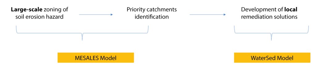
The MESALES model (INRA – now INRAE) is an expert model for mapping erosive hazards (soil sensitivity to detachment under the action of raindrops – « splash effect ») (Le Bissonnais et al., 1998, Chabert et al. 2020). There is a guide for application at departmental level (Cerdan et al., 2006 BRGM/RP-55104-FR). This mapping can be used to rank the catchment according to the hazard level and to identify priority catchment areas, on which WaterSed modelling can be carried out.
To set up a WaterSed model, sufficiently resolved data is required. The procedure for preparing input data is detailed in Tutorial 2 (see above).
